Capture the actual site
If we stitch the 360 photos into a rough walkable map, we get a shared reference: ferry approach, road edge, waiting areas, trees, signs, slopes, bay views and pinch points.
Dunwich (Gumpi/Goompi) ferry terminal is a live public project and a local place people already understand. A rough 360-photo map can let community members point to the actual site, add one idea at a time, then test it in outside image, video, three-dimensional (3D) and four-dimensional (4D) world-building tools.
On Sunday 7 June 2026, the field visit captured about 30 GoPro Max 360 photos around the terminal area. Those photos are not embedded here yet. The job of this page is to describe how that kind of capture can become a simple community map for testing generative artificial intelligence (AI) ideas.
If we stitch the 360 photos into a rough walkable map, we get a shared reference: ferry approach, road edge, waiting areas, trees, signs, slopes, bay views and pinch points.
If a person adds one clear change, such as shade, seating, public art, safer crossing or clearer queueing, the model has a clean job instead of a word salad.
If the community can compare renders against the same site map, people can talk about what fits, what feels wrong and what needs proper engineering before anyone treats it as a plan.
Artist impressions are useful for a first look, but they are not enough for local capability. The stronger ask is for shareable project files that let residents, students, makers and reviewers understand the real site.
This is the kind of paragraph a person could paste into Nano Banana 2, World Labs, Google Genie, Blender-assisted world tools or another visual model after attaching the real reference photos.
Create a realistic 16:9 community consultation image of the Dunwich (Gumpi/Goompi) ferry terminal upgrade area from pedestrian eye level near the public hall and ferry approach, using the attached 360 photos as the site reference. Show the existing ferry gateway, road edge, waiting area, trees, bay context, signs as blank unreadable shapes, and one proposed improvement: a shaded public seating and information zone that feels practical, coastal and locally made. Keep people anonymous, do not invent official approval, do not add readable private text, and keep the scene grounded in the actual site rather than making a glossy resort render.
Use the current site and one visible change. Make it easy to judge whether the idea fits the real place.
Change one control: time of day, weather, crowd level, queue layout, shade size, seating material or camera angle.
Every output should say whether it is a photo reference, community concept, official source, mock-up or later engineering issue.
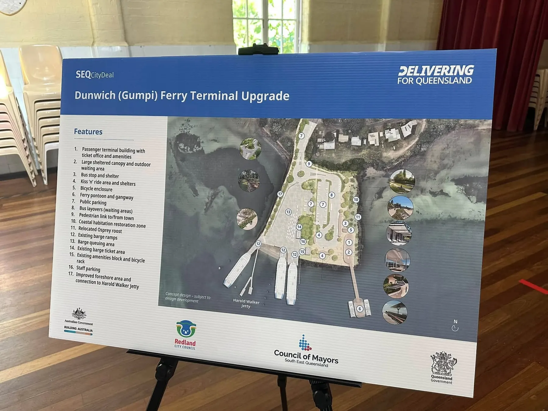
Goompi Ferry Terminal Trip is a satirical field note about public money, local capability and the difference between a glossy render and usable project knowledge. The chorus is the plain ask: give the community the raw data, the measured files and the right to build skills with them.
"Give us the point cloud, baby, give us the raw."
That line is the whole brief: public infrastructure should leave behind local know-how, not just a picture on a board.Transport and Main Roads page for the Dunwich (Gumpi) Ferry Terminal Upgrade, concept design, features, funding and consultation.
Open TMR project pageState Development project listing for location, responsibility, milestones and $41 million investment.
Open City Deal pageThe hero image is a WebP photo of the public concept board from the local field visit. The full GoPro Max 360 photo set is not embedded in this repo yet.
Use the Level 1 (L1) place prompt builder, paste one ferry-terminal idea, then export a Markdown (.md) prompt file.
Open prompt builder